As Hyundai Motor Group strives to commercialize level 3 autonomous driving technology, Hyundai AutoEver is working to create and supply high-definition maps necessary for autonomous driving, using its industry-leading map creation technology.
Hyundai AutoEver recently completed the development of Map Auto Creation (MAC) technology which produces a high-definition map based on road data faster and more accurately. We interviewed the engineers behind the creation of the technology, asking them about special maps for autonomous driving and the future of mapping technology.
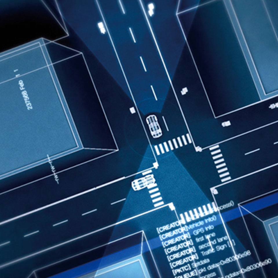
Car maps can be classified into three categories: navigation map, Advanced Driver Assistance System (ADAS) maps and high-definition maps. Navigation maps are commonly used to help human drivers find their route and navigate to their destinations. ADAS maps are more advanced, and contain more detailed information such as road angle as well as incline and decline, to support safe operation of ADAS. The high-definition maps for autonomous driving cars contain much more sophisticated data than the other two maps.
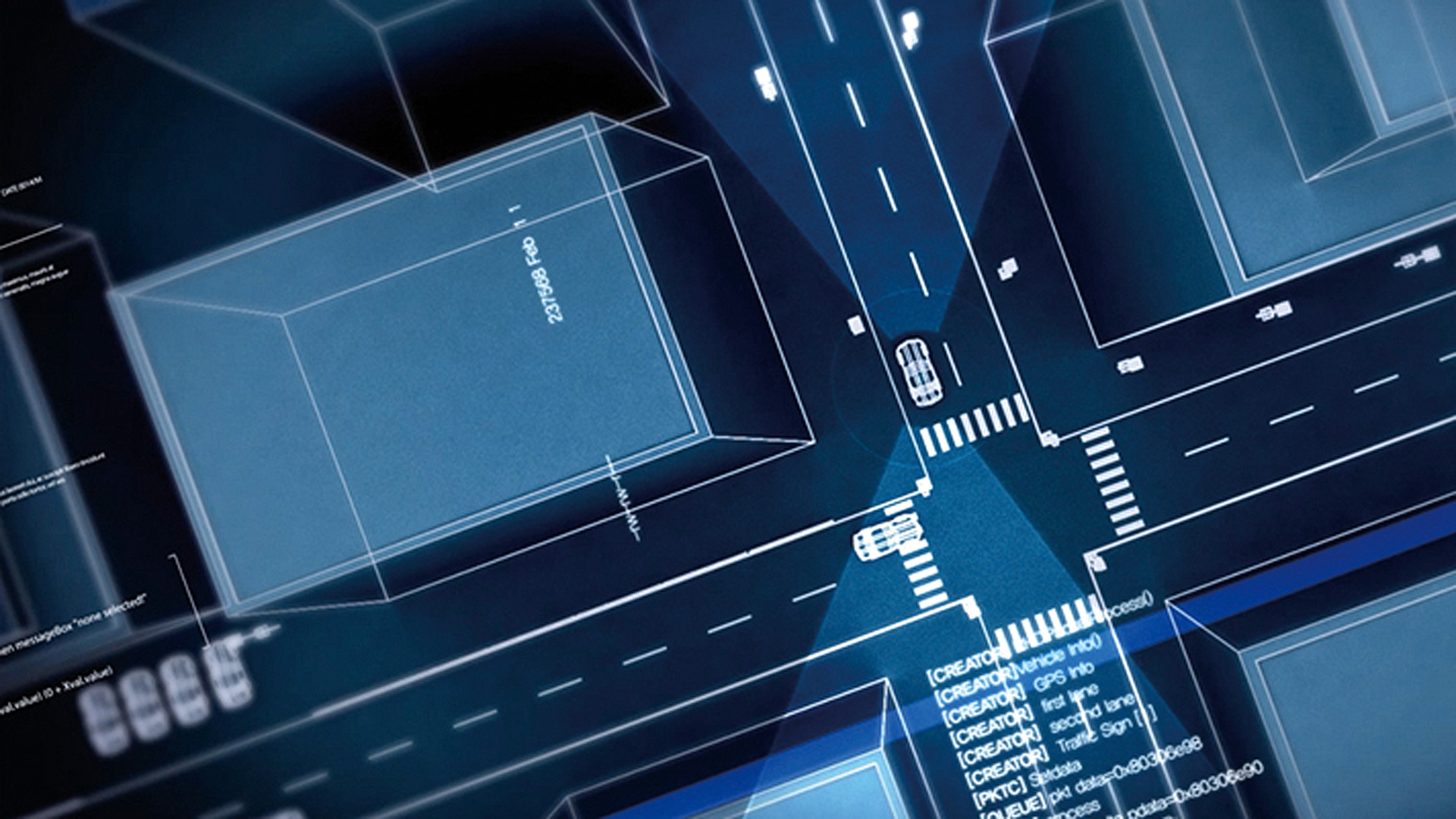
Level 3 autonomous cars are capable of advanced functionalities such as changing lanes and avoiding obstacles without driver input. Autonomous cars are equipped with advanced devices such as cameras, LiDAR and communication modules and are “trained” using simulators. However, these alone are not enough to make Level 3 autonomous driving work. For example, malfunction of a device or bad weather conditions such as snow or thick fog, can make it nearly impossible for a vehicle to recognize the surroundings. This is why Hyundai AutoEver is developing high-definition (HD) maps.
HD maps have high precision data on the road boundaries, lanes and various objects with accuracy of a few centimeters. While navigation maps can tell which road the car is on, HD maps allow the vehicle to recognize not just that, but which lane the vehicle is on. HD maps contain high precision 3D information on vehicle lanes, traffic lights, pedestrian walks, road signs and road marks, helping autonomous cars navigate the road even in bad weather or when sensors do not work.
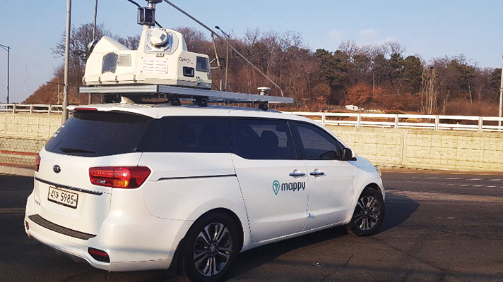
MAC automatically creates maps using raw data. MAC was invented by integrating various technologies necessary for the creation of HD maps. MAC processes the data collected using vehicles with Mobile Mapping System (MMS) and automatically classifies the objects it detects into appropriate categories such as lane marks and road signs. In the past, such classification and verification were conducted manually which was not only time consuming but inaccurate. By contrast, MAC is capable of detecting lane marks and road signs with more than 98% accuracy, and location information with a margin of error within 20 cm. MAC dramatically reduced the time required to create HD maps. In the past, it took about 200 hours to create an HD map for a 100 km route. MAC makes it possible to complete the same task more than 20 times faster.
Q. What was the key focus of MAC software development?
Increasing the accuracy of autonomous processing using deep-learning based AI was one of the core development goals. We have created an optimized software model to improve object detection and position data accuracy, as well as a dataset to improve the object detection capability of the AI. Our effort paid off handsomely with MAC’s detection rate reaching over 98%. We are working to further improve it to 99.9%.
Q. Road environments can vary widely especially when they are under construction. How do you work around such variables?
Yes, there are limitations when collecting road data especially when they are undergoing changes. We are working on creating what we call ”Red Box,” which is equipped with a camera and an LTE modem and can be placed on regular cars, to detect changes made to the roads. The idea is to have Red Box collect visual data on the roads using the camera and to send it to the HD map data server. When many vehicles have the Red Box, we will be able to identify changes in real time and update the HD map immediately.
Q. Is autonomous driving the only application of HD mapping technology?
HD mapping technology can be used in many areas beside autonomous cars. It can be used to create digital twins to improve navigation systems and for autonomous valet parking where high-precision geospatial data is needed. HD mapping can also be used in the management of road signs and traffic lights. HD maps contain so much data and information, that their applications are only expected to increase over time.
Q. Many companies including Google, Apple and Amazon are working to improve their HD mapping capabilities. What are the latest trends in HD mapping?
I think “collaboration” is the key trend in HD mapping. Many companies are forming strategic alliances, due to the high cost required for development. Standardization of the HD mapping data format is also happening to make different data sets compatible. Hyundai AutoEver is involved in the establishment of an international standard. We are working to form partnerships with global companies as well as start-ups to create synergy and explore new business opportunities.
Advisor. Principal Research Engineer Sang-hun Kim, HDMap Development Team at Hyundai AutoEver