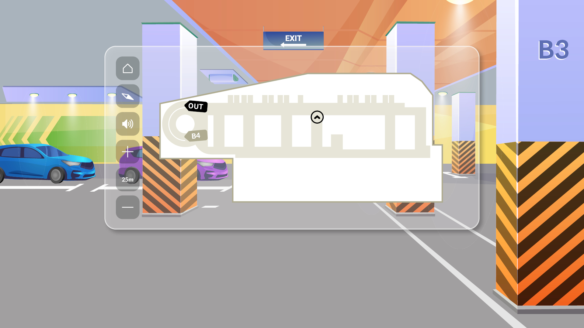
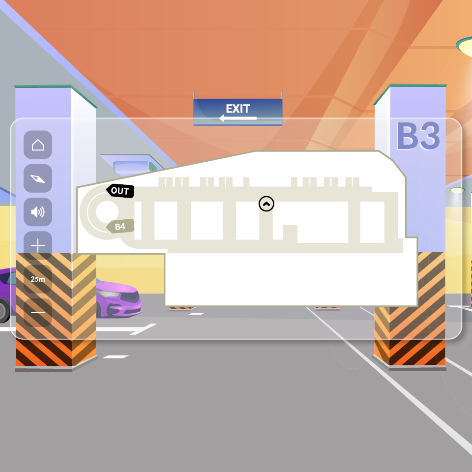


Navigation has become a useful tool that provides not only simple directions but also real-time traffic information, optimal routes, information on restaurants, tourist attractions, bank branches, ATMs, and other useful information reflecting the needs of users. However, these services are only available outside.
It would be really great if navigation systems could guide you even in a large and complex building or underground. That’s why Hyundai Autoever has developed a function that allows navigation to guide in indoor parking lots of apartment complexes or multi-purpose facilities. The core technology that enables this is the “indoor parking lot map.”
Inside an apartment or multi-purpose facility, the car’s navigation system may lose direction because it is difficult to measure accurate GPS or understand the internal routes of the parking lot. To solve this inconvenience, Hyundai Autoever is developing software that produces building maps as well as maps of indoor parking lots so that navigation terminals can display them accurately.
The idea of the indoor parking lot map began with the need for indoor parking lot navigation for apartment complex residents. Hyundai Motor, Hyundai Construction, and Hyundai Autoever started development after thorough discussion.
First, Hyundai Construction provided communication information such as indoor parking lot design drawings and parking slot information, and based on this, Hyundai Autoever verified the data for the indoor parking lot map and developed the software. Then, Hyundai Motor developed a network system that allows the map data that Hyundai Autoever constructed to be linked to vehicles through navigation.
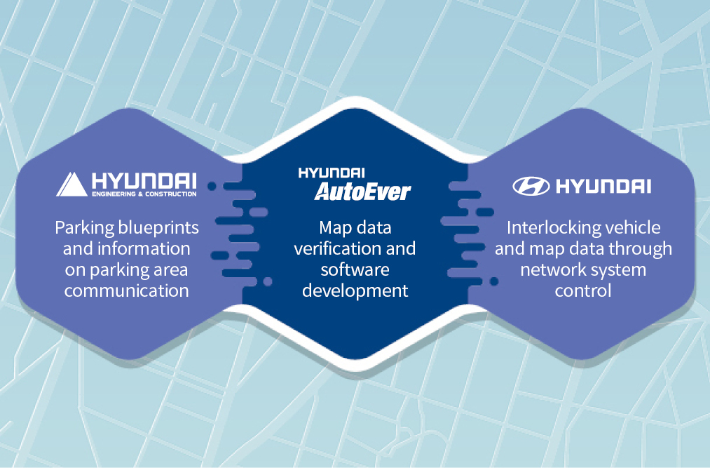
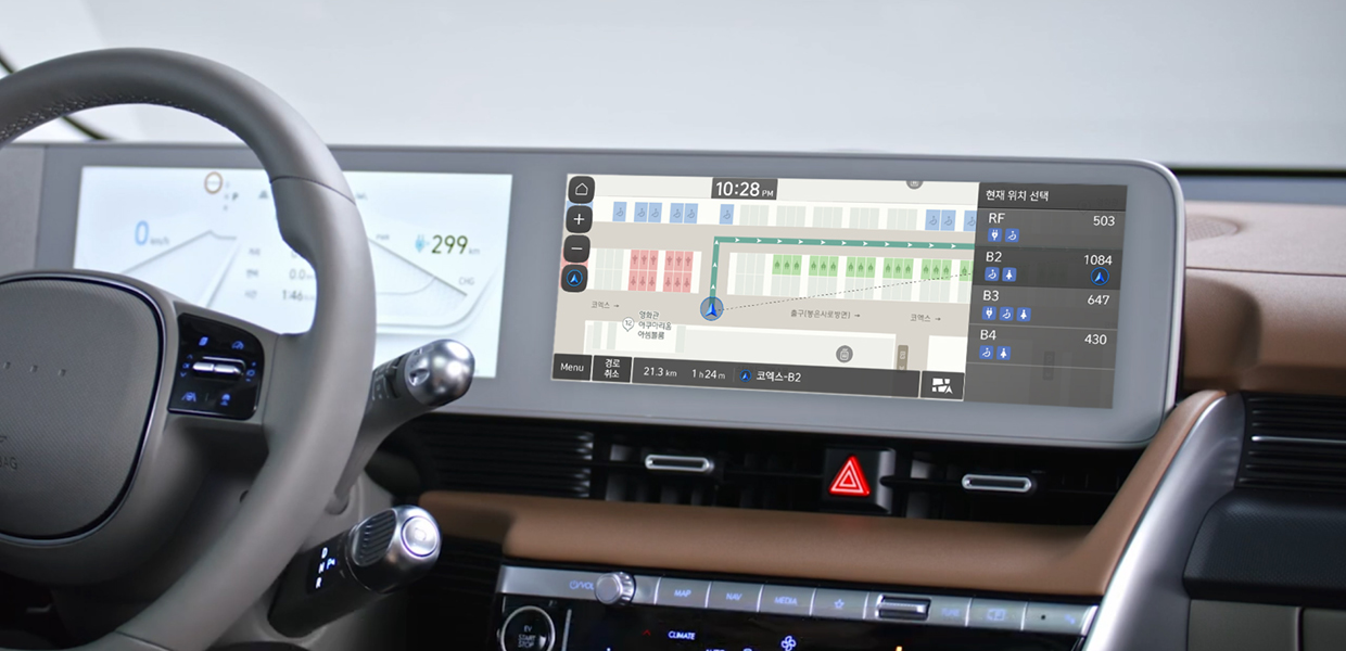
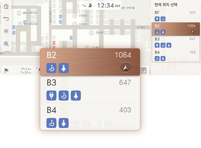
As a result, in March of last year, the indoor parking lot guidance service was first launched at The H Banpo Raclasse and The H Xi Gaepo. The most well-received service is monitoring parking slots in real-time and informing vacant parking spaces. In addition, it provides infrastructure information such as electric vehicle charging stations, handicap parking spaces, unmanned parcel delivery, and building entrances.
To create an indoor parking map, precise positioning technology for accurately identifying the space and a digital map that processes map data to suit the service orientation are essential.
① Precise positioning technology for accurate map production
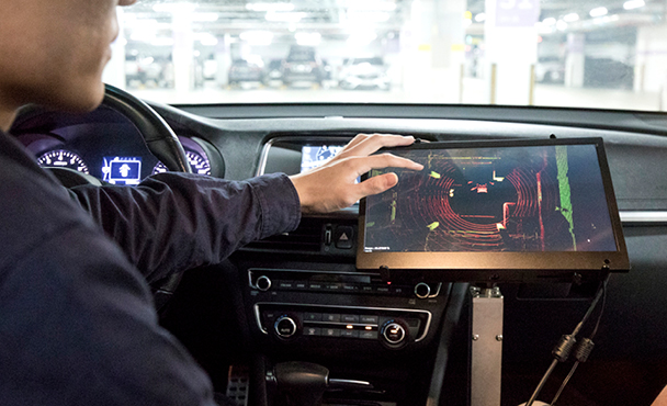
Indoor parking maps require a higher level of accuracy than general flat maps. Hyundai Autoever has developed a specialized indoor parking survey vehicle equipped with Lidar, cameras, and high-precision positioning devices, which are utilized to create indoor parking maps.
Research is underway to improve the accuracy of positioning technology that maps the current location onto the established indoor parking map using various methods such as “Beacon,” “WiFi,” “AR,” and “ultrasound.” These technologies can be applied to various platforms such as AI robots, navigation systems, and web maps.
② ‘Digital Map’, key data for detailed information on parking lots
The indoor parking lot navigation service is provided through a digital map that provides directions in an indoor parking lot where GPS does not work. To develop a digital map, CAD drawings inside the parking lot or SLAM (Simultaneous Localization and Mapping) equipment acquire raw data.
Using this, the device builds a map of the inside of an indoor parking lot in a database. Afterwards, the map data is converted to create a digital map specific to the service. The digital map is used according to the purpose of each platform, such as navigation, web map, and mobile map, depending on the purpose.

Currently, indoor maps are used for many purposes, and each has a different construction technology and format. In the future, various map construction technologies developed centering on various services will be converged and gradually integrated and standardized into one indoor map. The key element at this time is the digital map that enables One Source Multi Use (OSMU).
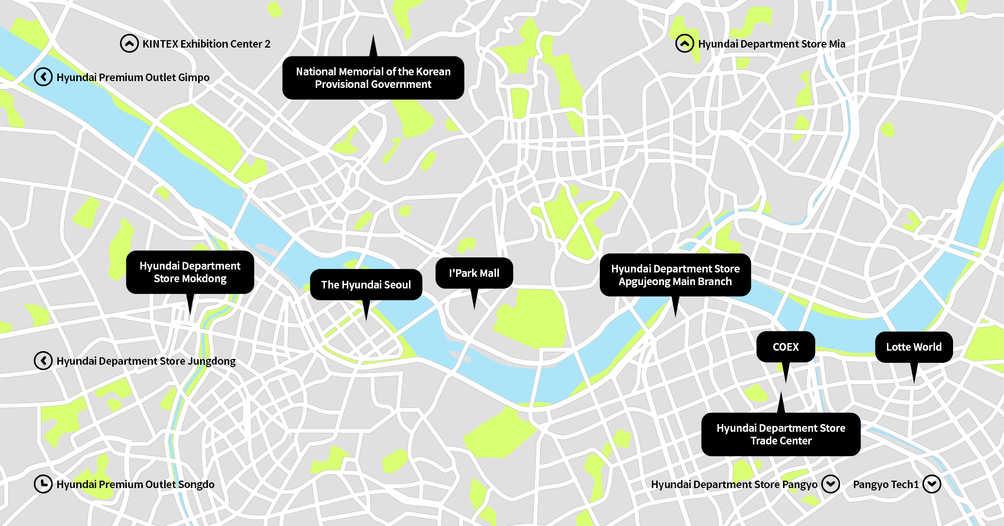
Hyundai Autoever has built indoor parking lot maps for complex facilities such as large shopping malls and outlets with many visitors in addition to apartments, and is using them for navigation so that more people can benefit from them. There are currently 15 indoor parking maps in the Seoul metropolitan area (as of January 1st), including COEX (Samsung), Lotte World (Jamsil), The Hyundai Seoul (Yeouido), and I’Park Mall (Yongsan). Even if you are not a resident of The H Apartment Complex, anyone using a Hyundai Motor Company, Kia, or Genesis vehicle can experience the indoor parking lot map search service at various complex facilities through the latest navigation update.
The indoor parking lot map of the complex contains various information such as the number of available parking spaces, car washes, restrooms, elevator locations, and column information. Information about the number of parking spaces on the current floor or the entrance to a parking lot is useful for drivers.
Hyundai Autoever plans to add parking maps to four locations, including Bitplex Wangsimni and Hyundai Department Store Cheonho, in January 2023, and 10 indoor locations, including Lotte Outlet Seoul Station and AK Mall Pyeongtaek, in March. We plan to provide service to about 10 branches in the future update cycle - every 2 months. In addition, they will expand the service to apartments where control information can be shared, and service to various other places through partnerships with mobility service application companies.

Direction guidance for drivers must be continued not only on roads but also inside buildings - through indoor parking lot navigation services implemented with positioning technology for precise maps inside buildings and digital map technology that can service the necessary data according to the purpose. Hyundai AutoEver plans to further develop indoor parking lot map technology and expand smart route guidance for owners of Hyundai Motors, Kia, and Genesis by utilizing it in various indoor and underground spaces.