
With the advent of the Software-Defined Vehicle (SDV) era, future mobility is evolving beyond hardware to be software-centric, closely connecting vehicles and services. The boundaries between the vehicle’s interior and exterior, as well as between driving and daily life, are gradually disappearing, and the experience of mobility is being redefined within a single, organic data flow.
At the center of this massive transformation, Hyundai AutoEver stands as the key software partner realizing the Hyundai Motor Group’s SDV strategy. From vehicle software platforms and navigation to the cloud connecting the inside and outside of the vehicle, data services analyzing mobility data, and infotainment, Hyundai AutoEver is expanding its scope to design the entire data-driven mobility experience.
In line with this trend, Hyundai AutoEver has unveiled “routo,” a data platform that spans beyond domestic maps to cover the global landscape. routo is a location-based service platform revamped in 2021, building on the foundation of PlayMap, which was launched in 2019. In April of this year, a website optimized for mobile devices was officially launched, and the 3D cherry blossom road map featured on the subsequently released routo demo web page became a hot topic.
The reason Hyundai AutoEver—which already provides high-definition maps and indoor parking lot map services to Hyundai, Kia, and Genesis vehicles—is steadily developing routo is clear. It aims to open up its mobility software capabilities accumulated over the years, not only for vehicles within the Hyundai Motor Group but also in the form of APIs and SDKs, to more closely connect the experience of mobility with everyday businesses and services.
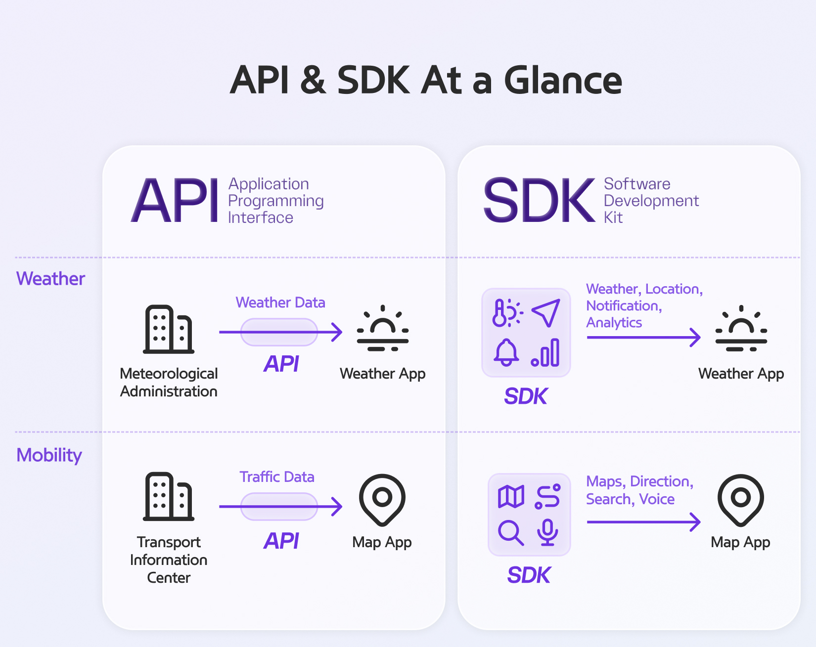
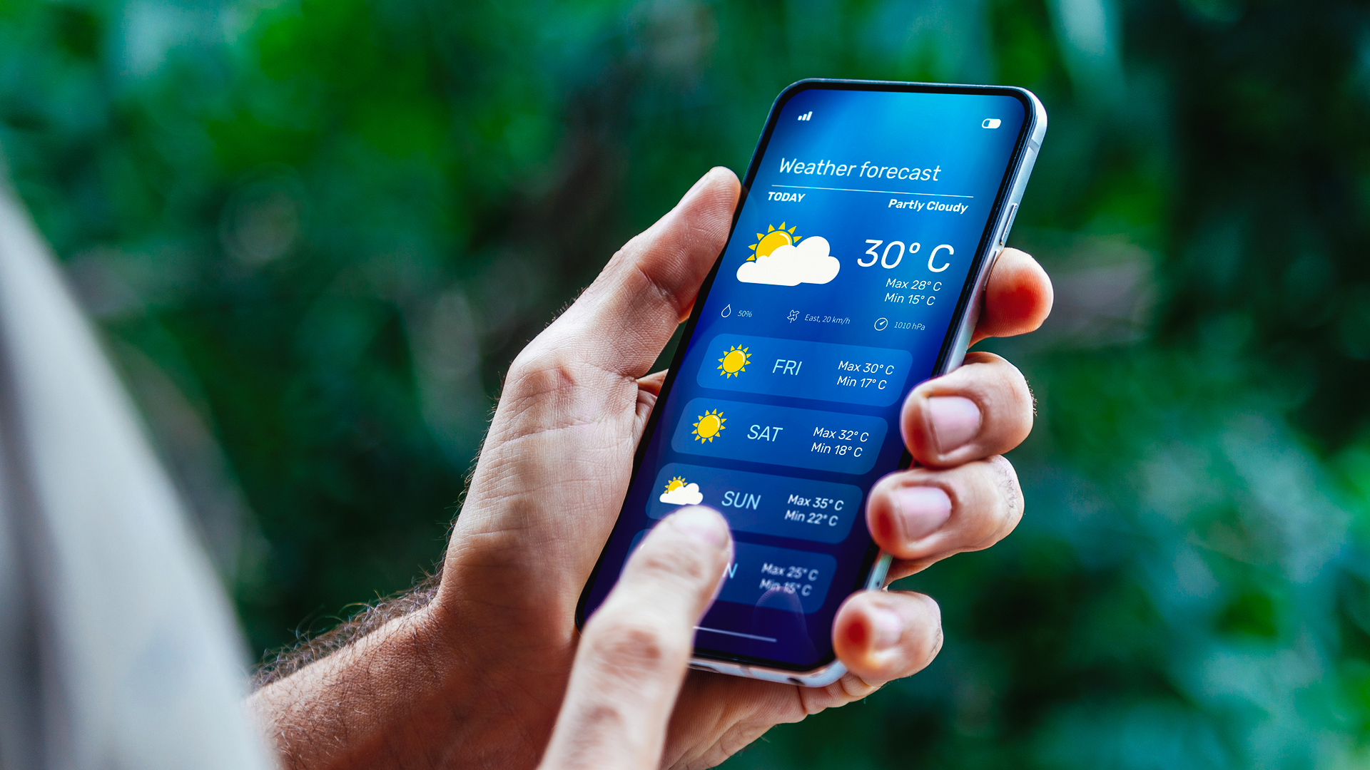
While APIs and SDKs may sound somewhat unfamiliar, they are technologies already deeply integrated into our daily lives. When you open a weather app, weather information appears immediately. We can access this information because the app retrieves data from the Korea Meteorological Administration. The “connection channel” that facilitates this exchange of information is the Application Programming Interface (API).
SDKs have a slightly broader scope. While an API is a specific channel for requesting and receiving necessary information, a Software Development Kit (SDK) is more like a “comprehensive toolbox” pre-configured to allow developers to easily utilize those functions when building apps. When developing in-car navigation systems, using an SDK allows developers to efficiently build apps tailored to their needs by integrating individual features (APIs), such as real-time traffic data or detailed parking lot maps. That’s why SDKs typically include multiple APIs and development tools.
For example, when a logistics company builds a delivery service, it can integrate only routo’s route-finding data via an API, or it can easily connect to routo’s various mapping features using an SDK. routo is a platform that provides location-based data—the foundation of our daily lives—in the form of APIs and SDKs. To learn more about routo, which is set to become even more deeply integrated into our daily lives by suggesting clearer travel routes, we met with Hee-tak Kwak and Ye-eun Jeong, managers of the Map Service Platform Team at Hyundai AutoEver.
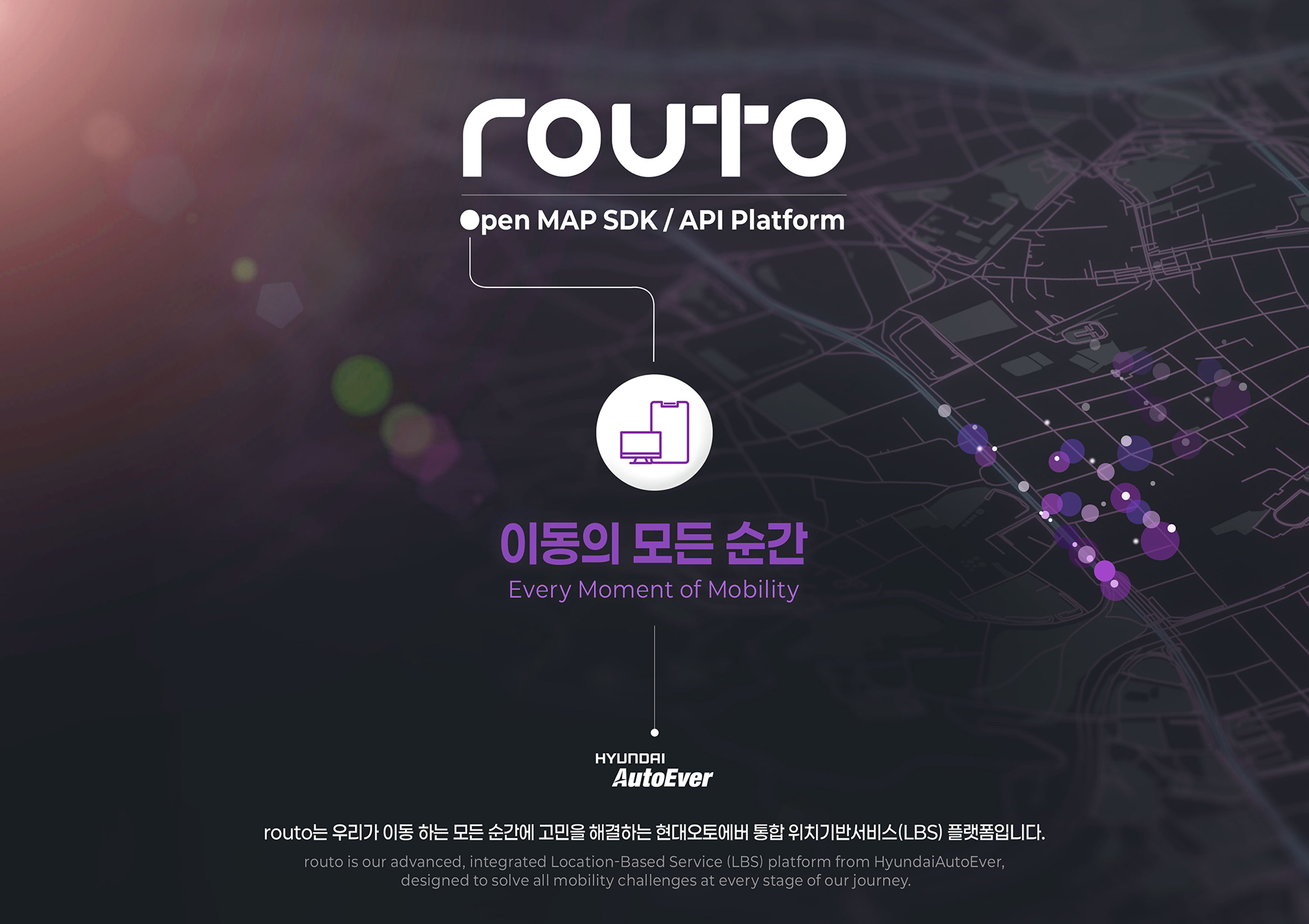
routo is a portmanteau of “route” and “protocol,” signifying its role as a channel for both mobility and data that connects every corner of the world. routo differs from the B2C map services we commonly encounter. While B2C maps assist individuals in convenient mobility, routo is a B2B data platform that provides tools to implement mobility services optimized for various industries.
routo has taken its first steps to transcend the limitations of existing map services by digitizing every movement on the roads and systematically connecting it. Hee-tak Kwak, a manager in charge of business planning at the Map Service Platform Team, explains that a “virtuous cycle of data” lies at the core of routo’s development.

“In the SDV era, vehicles and services are closely interconnected. We collect location data provided by platform participants, verify it through a rigorous process, and then provide it back to users via the routo platform. We aimed to create a virtuous cycle where participants use this improved information to experience better mobility, which in turn generates new data.”
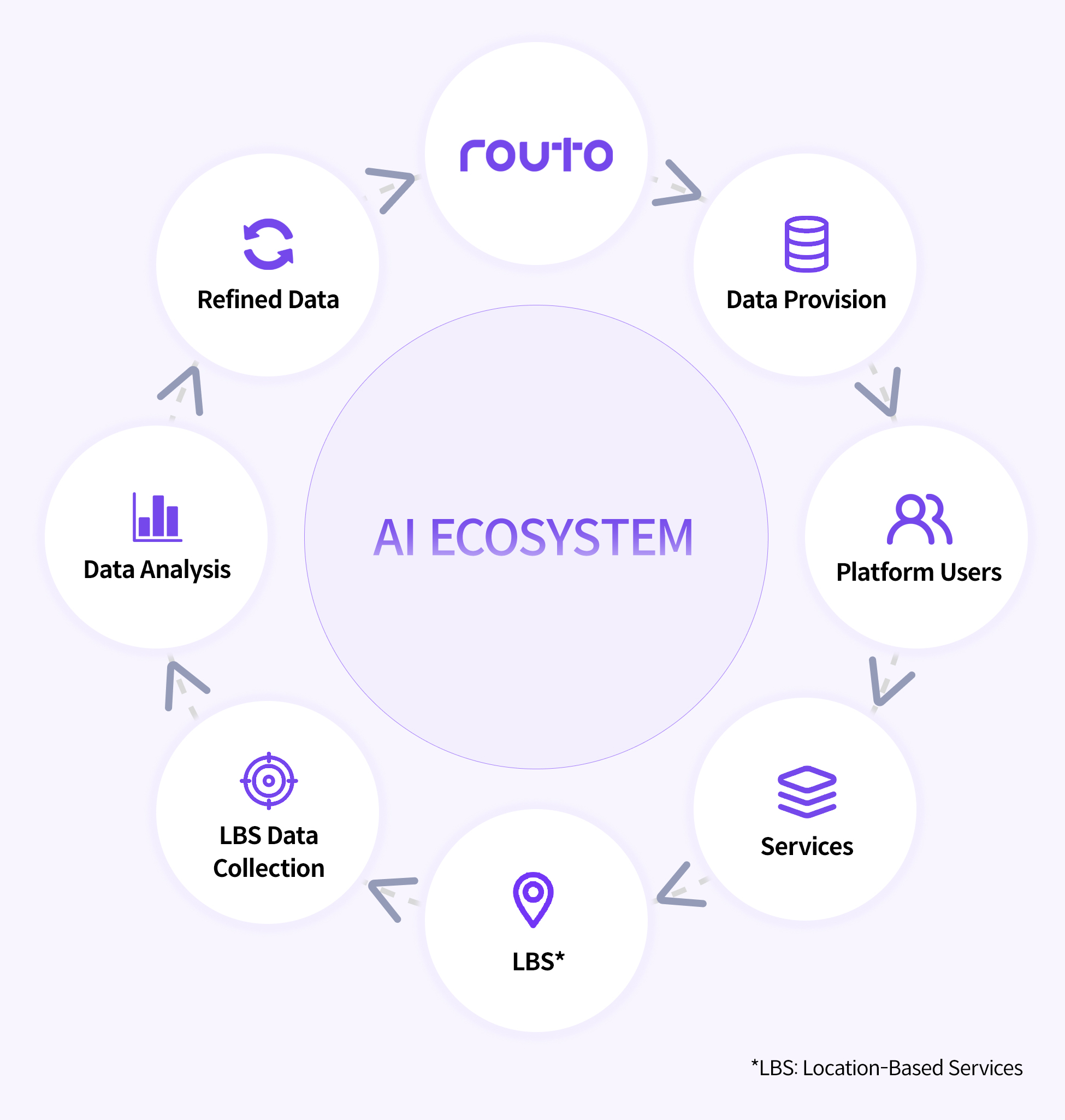
The scope of data processed by routo is extremely broad. It rapidly processes and reflects on maps everything from road data accumulated as vehicles drive to user-submitted photos collected while walking. In particular, the vast amount of road data secured across the Hyundai Motor Group serves as the foundation for implementing even more sophisticated map services. It enables users of routo-integrated apps to experience spatial information that is significantly more realistic than traditional map services at every moment of their journey.
So, let’s explore how routo’s maps bring spatial experiences to life through four key APIs that intuitively demonstrate the core capabilities of the API and SDK services provided by routo.
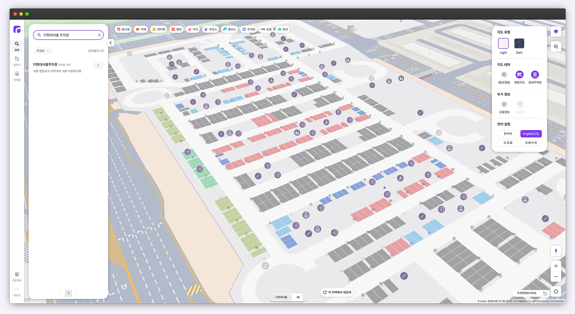
We’ve all had the experience of wasting time going up and down multiple floors in a massive shopping mall’s underground parking garage because we couldn’t remember where we parked. Unlike standard maps that merely guide you to the entrance of your destination, routo’s “Maps API” precisely visualizes the complex layout of indoor parking garages. In fact, routo’s indoor parking maps are already in use at large-scale facilities such as Hyundai E&C’s The H Banpo La Classe, COEX, Lotte World, and Hyundai Department Stores, helping to enhance user convenience.
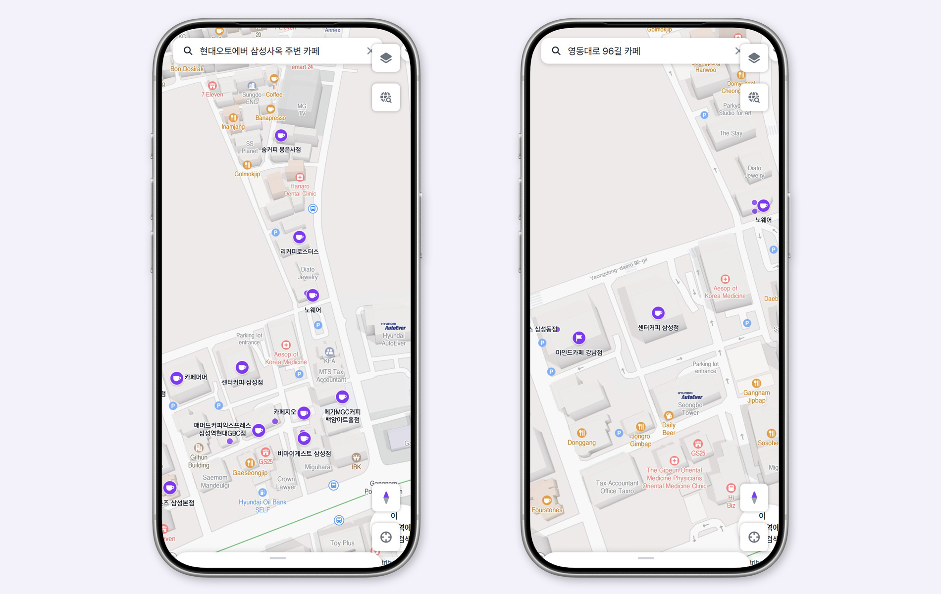
Next is the “Places API.” Places API visualizes the latest commercial districts and ever-changing spatial information on a map. It is a common occurrence in daily life to see a place that was a café yesterday turn into a different store today. In such a rapidly changing environment, providing customers with accurate location information is directly linked to business credibility. The core search engine supporting Places API precisely identifies users’ intention to suggest the most relevant information, while continuously updating data in near real-time.
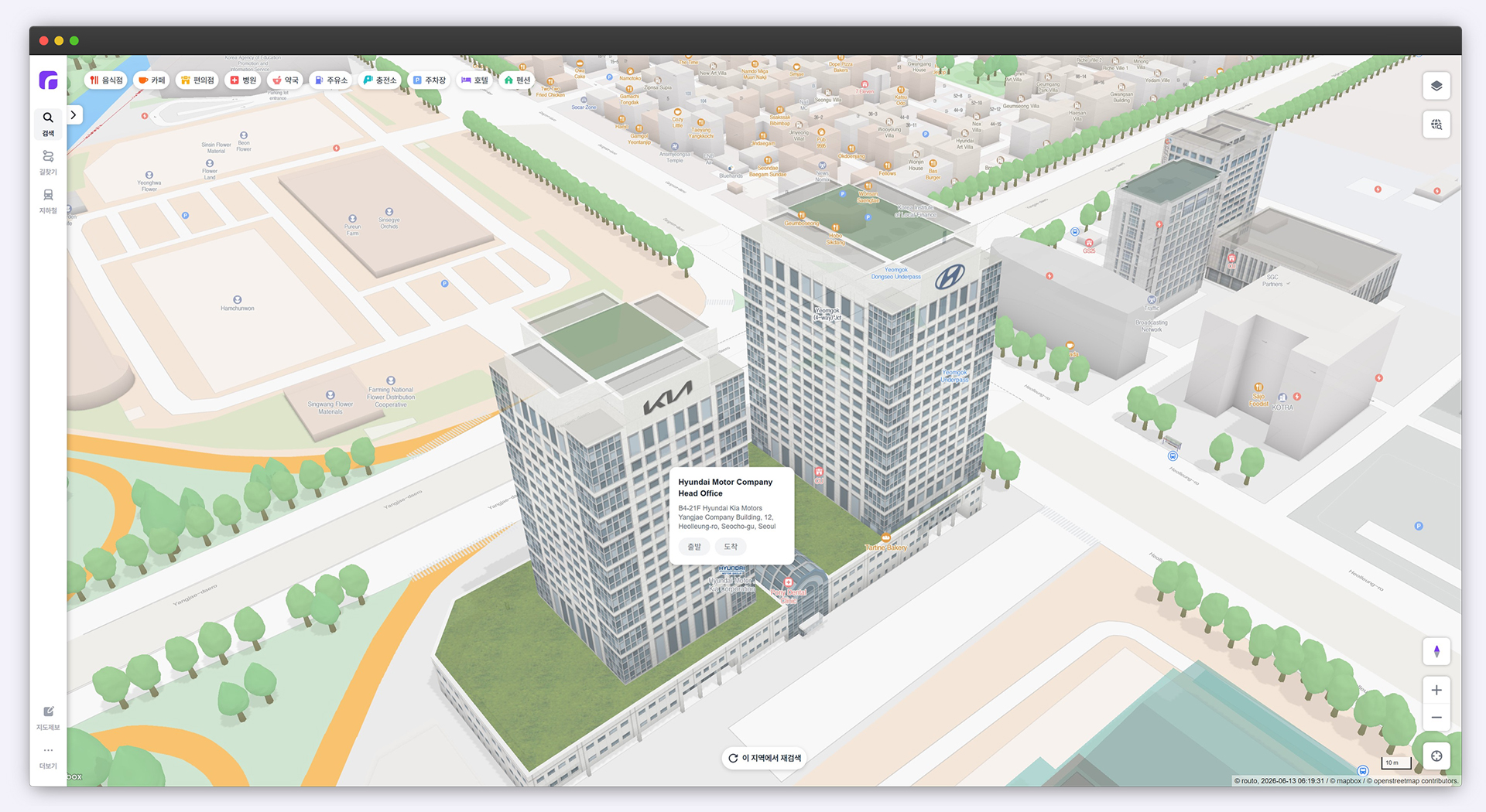
One of the most representative map-related apps is a taxi-hailing service. Setting your current location coordinates when hailing a taxi feels like second nature, but behind this feature lies a process of translating “coordinates”, the language of machines, into “addresses”, the language of humans. routo’s “Geo API” is responsible for this critical translation role. Geo API flexibly converts between addresses and map coordinates. For example, if you enter “Gangnam-gu, Seoul,” it finds the exact location on the map; conversely, if you pinpoint a location, it provides the street address, postal code, building number, and administrative district information.
Finally, routo’s “Directions API” finds the optimal route from the starting point to the destination. When considering various routes to travel from Seoul to Jeju Island, Directions API guides you through the entire journey—from walking to airport buses, flights, and taxis—providing details on transfer routes and travel paths.
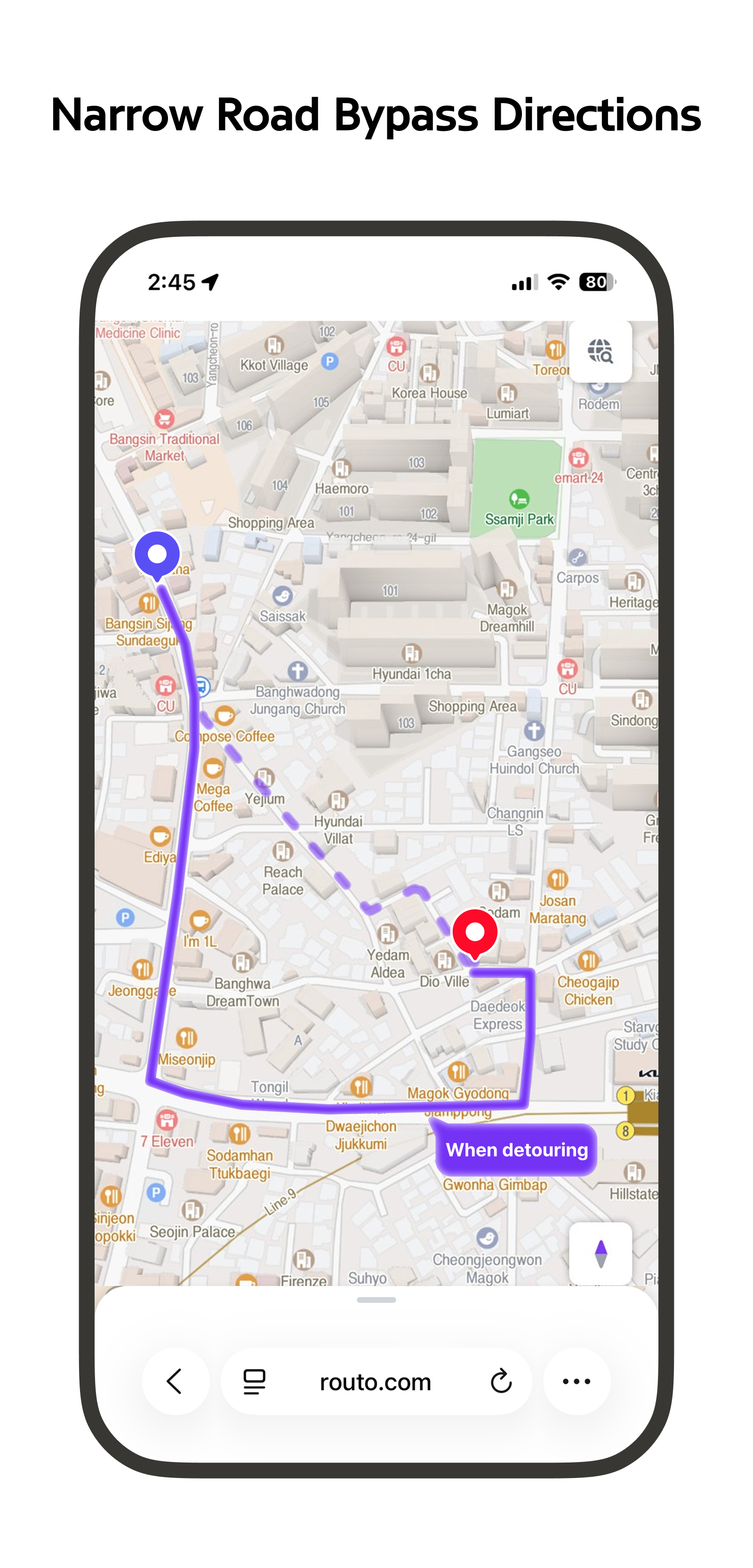
routo’s Directions API not only handles multi-stop route planning but also designs routes specifically for commercial vehicles(CV). Due to height and size restrictions, CV often cannot use standard navigation routes. routo resolves this issue using its collected data. By pre-collecting relevant data —such as whether a vehicle’s load exceeds a bridge’s weight limit or whether an underpass is high enough for a truck to pass through—, it recommends routes that commercial vehicles can safely navigate.
In fact, Hyundai Glovis, one of routo’s flagship clients, uses a logistics management system powered by the routo’s Directions API to deliver finished vehicles and parts. As a result, they are able to improve logistics efficiency by using the optimal routes for commercial vehicles without having to search for alternative routes multiple times.
Besides, routo’s APIs are being utilized across various sectors—such as terminal systems for police patrol vehicles and local taxi hailing services (in Busan, Incheon, etc.)—and has proven its value. And the routo platform is expanding even further. This is because Hyundai AutoEver is providing routo Maps as an SDK, expanding its scope of application into a wider range of services in the development market. routo demonstrates limitless potential for expansion across various industries, including delivery services, travel route recommendations, public safety services, and smart cities.
Now that the domestic and international map service markets have entered a mature phase, Hyundai AutoEver is focusing more on building a differentiated location-based platform based on the Hyundai Motor Group’s wealth of experience and technological capabilities.
The first point of differentiation is “speed.” In map services, where real-time performance is key, speed is synonymous with competitiveness. To create maps that most closely resemble reality, Hyundai AutoEver has been refined a system that collects and processes real-time data and immediately reflects it in the service. Ye-eun Jeong, a manager responsible for implementing various spatial data on the routo website, cited “daily updates” as one of routo’s strengths.
“We are among the fastest in the domestic market at quickly reflecting information on newly opened stores or roads in our service. By combining vast amounts of vehicle data with AI technology, we continuously maintain the timeliness and accuracy of our data. Location information uploaded yesterday can be searched for as early as tomorrow, and newly opened roads or buildings are also updated swiftly. Through this daily update system, we capture the changing road environment in near real time.”

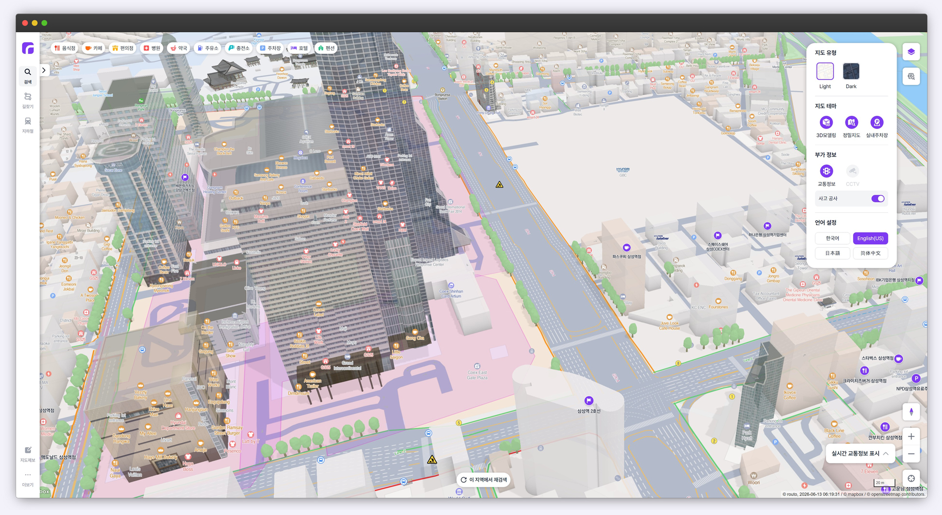
Hyundai AutoEver focused not only on the speed of data but also on the “intuitive experience” for users. No matter how high the speed and accuracy of data may be, how easily and immediately users can understand it is a separate issue. routo has differentiated itself in how it delivers information by using “Data Mashup” and “3D Modeling” to organically and three-dimensionally display information on popular restaurants, parking lots, and real-time events around a destination on a single screen.
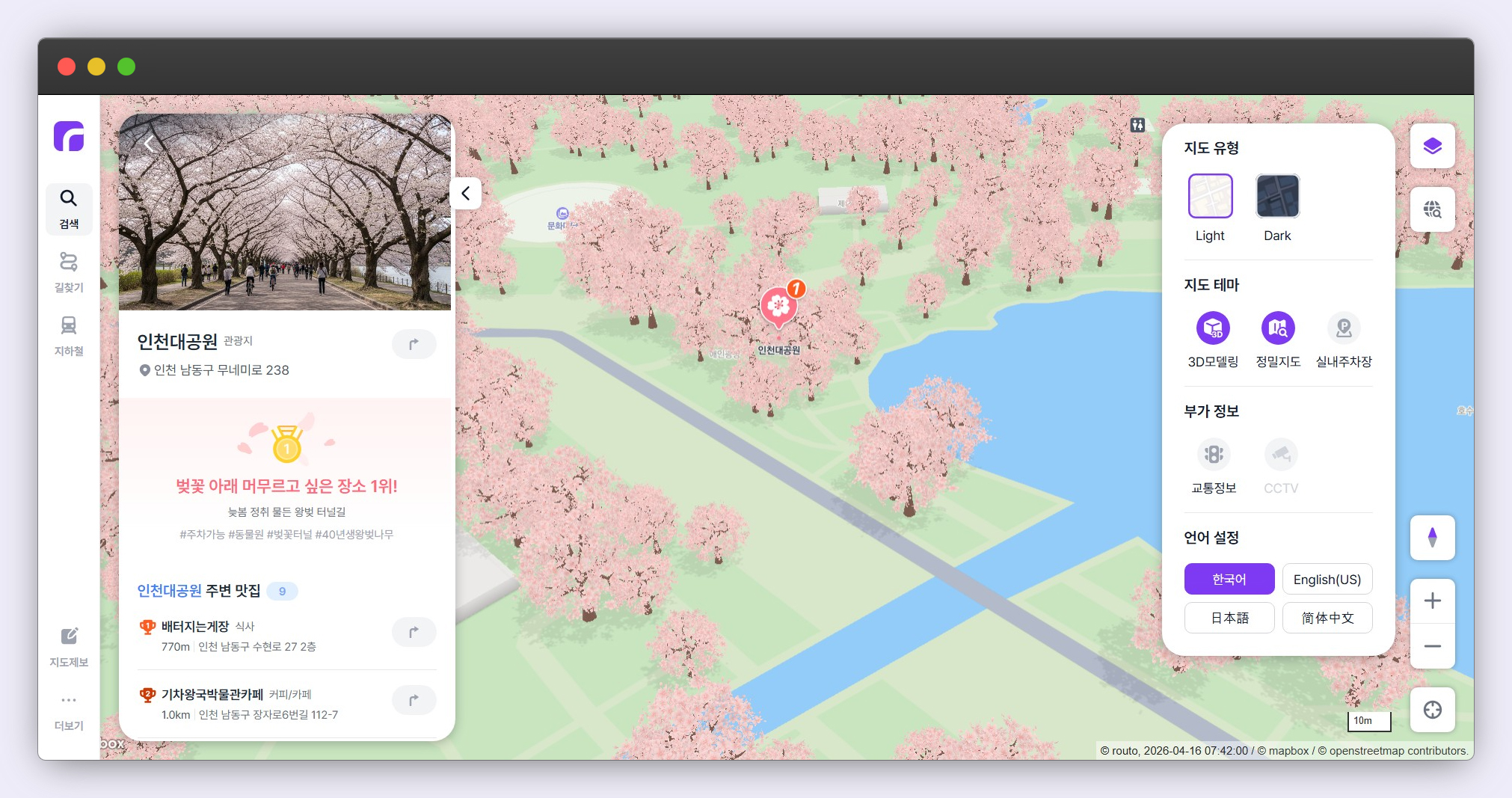
The cherry blossom-themed map mentioned earlier is a prime example of routo’s 3D visualization technology. Ye-eun Jeong, the project lead who has been planning seasonal theme maps since last year’s autumn foliage theme, explained the rationale behind the project, saying, “I wanted to show developers and customers how routo can be utilized.” Indeed, routo brought the map to life by rendering tree data on the map as 3D cherry blossom trees. Jeong announced that they will continue to introduce theme services that make the mobility experience more intuitive and enriching.
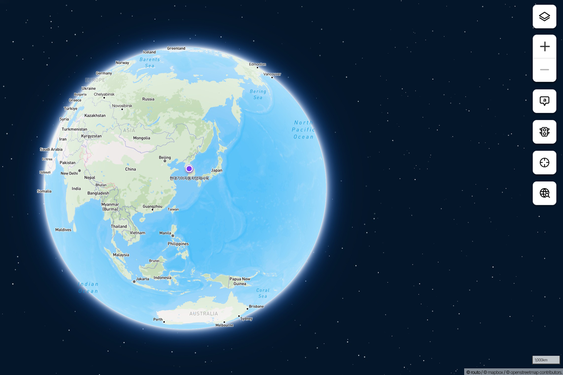
Finally, “global coverage” is another major strength of routo. Manager Hee-tak Kwak, while discussing routo’s potential, noted the following regarding the current map service ecosystem.

“While the domestic market is dominated by lifestyle-oriented services centered around super apps, the global market features a well-developed ecosystem centered on APIs and platforms. routo’s major strength lies in its ability to encompass both of these approaches. Furthermore, by applying a world-class rendering engine, we provide Korea’s first global map service. This means that even when developing global-facing apps domestically, you no longer need to rely on overseas companies.”
As such, routo’s ability to anticipate changes on the road is expanding beyond the refinement of domestic maps to the entire world. This is why we look forward to routo’s future as it emerges as a core infrastructure spanning the entire business landscape.
What will the “world connecting all mobility beyond maps,” envisioned by Hyundai AutoEver, look like? Regarding routo’s vision, Manager Hee-tak Kwak stated, “We will provide a unrivaled development experience and high-quality infrastructure optimized for local data in a global market dominated by APIs from multinational corporations,” expressing his bold ambition to “maintain the competitiveness of South Korea’s map data and become a new alternative in the mobility market.” Manager Ye-eun Jeong echoed this sentiment, stating, “We will continue to combine rich content with sophisticated technology to build a platform that delivers overwhelming value to both B2B partners and users.”

Building on the software capabilities accumulated to date, routo is evolving into an “intelligent mobility platform” that connects all movements of people and objects, continuously expanding its scope to become a core infrastructure for future mobility spanning autonomous driving, smart cities, and robotics.

Even at this very moment, Hyundai AutoEver’s routo is swiftly detecting the slightest changes on every road, clearly charting a new course for the future mobility we envision. The path of mobility designed by routo will go beyond the mere shifting of coordinates to become the most definitive milestone toward a more efficient and safer future.